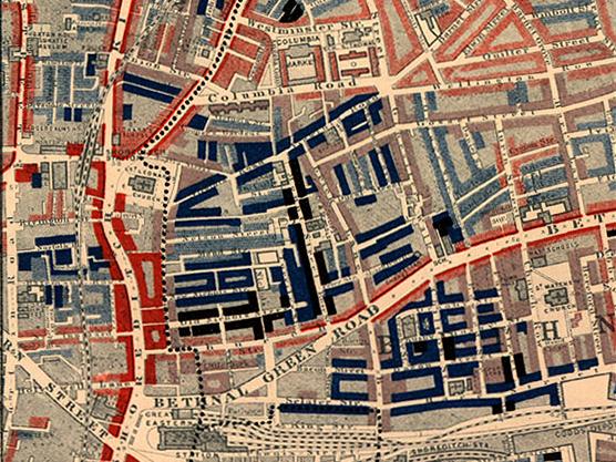
Poverty map of Old Nichol slum, East End of London, showing Bethnal Green Road, from Charles Booth’s Labour and Life of the People. Volume 1: East London (London: Macmillan, 1889). The streets are colored to represent the economic class of the residents: Yellow (“Upper-middle and Upper classes, Wealthy”), red (“Lower middle class – Well-to-do middle class”), pink (“Fairly comfortable good ordinary earnings”), blue (“Intermittent or casual earnings”), and black (“lowest class…occasional labourers, street sellers, loafers, criminals and semi-criminals”). Courtesy of Wikimedia Commons: http://en.wikipedia.org/wiki/File:Poverty_map_old_nichol_1889.jpg
